UNDERSTANDING PEOPLE IN PLACES
 The purpose of the People in Places project is to demonstrate the utility of geographically-tied social science information for fish and wildlife management and to introduce and test a spatially-explicit approach. Current approaches to understanding the human dimensions of fish and wildlife management often employ broad-based surveys and interviews that provide important insights for understanding stakeholders. However, these approaches typically are constrained in their application because they lack geographic specificity. In particular, information about human values, attitudes, and behaviors would be most useful if examined in the context of a specific community or the location of a particular resource problem. Often, it is this spatial context, characterized by people’s proximity to the resource, which helps shape the nature of human-wildlife interactions and forms the basis for the rise of management problems.
Data collection for this project, which was a multi-state effort of the Western Association of Fish and Wildlife Agencies in cooperation with Colorado State University (funded by participating state agency contributions), occurred in Arizona, Montana, South Dakota, and Washington. Results were used to develop maps depicting conflict hot spot zones, or areas where agencies can anticipate mixed public sentiment or resistance to proposed management strategies. When coupled with biological data (e.g., species distributions), findings offer a useful tool for managers attempting to deal with human-wildlife conflict and public education at more local levels.
STATE PROJECT REPORTS
COUNTY LEVEL RESULTS
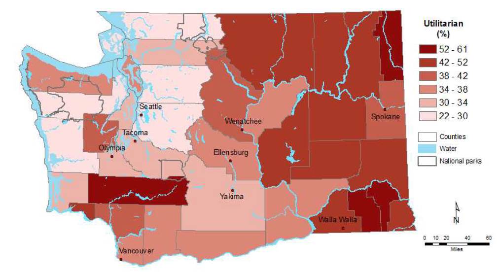
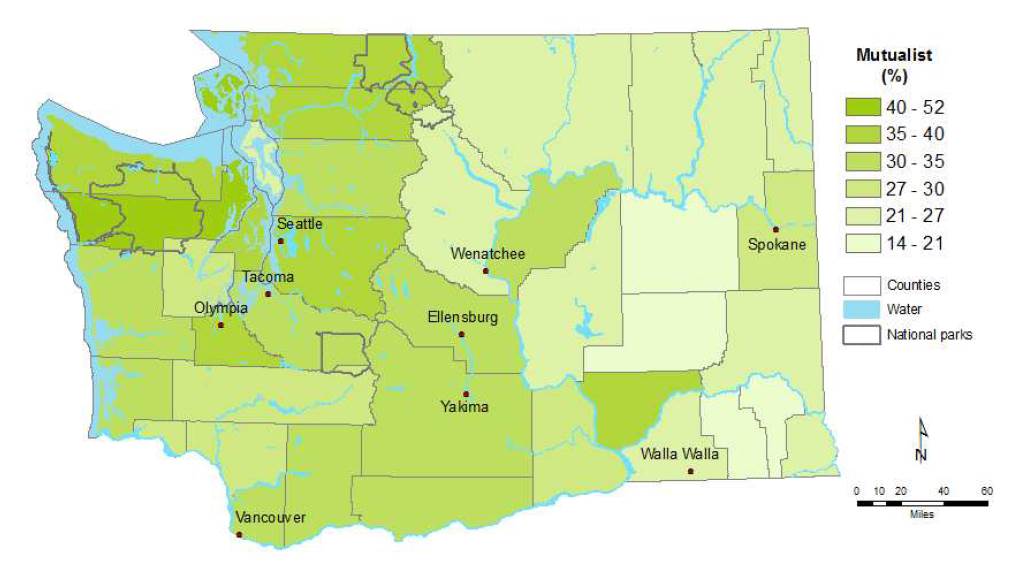
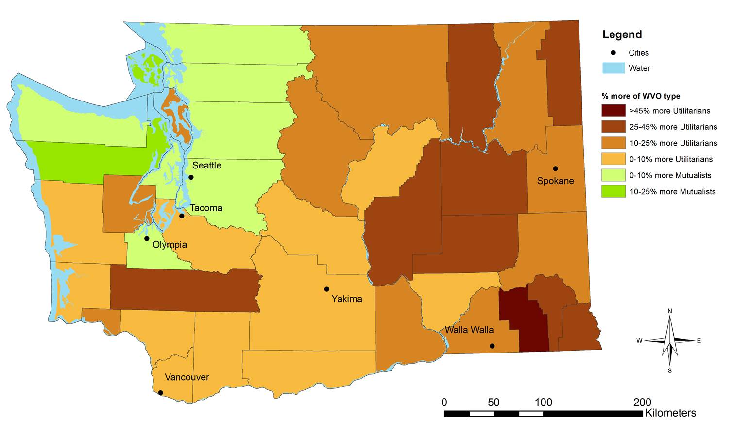
Collecting data at the county level in Washington allows for a fine scale look at how wildlife value orientations vary across the landscape. Finer degrees of resolution for wildlife values information allows for results to be viewed within relevant spatial and managerial contexts. Click the below according to view high resolution data on Washington state.
