Tree spatial pattern effects on regeneration niches in mixed-conifer forests
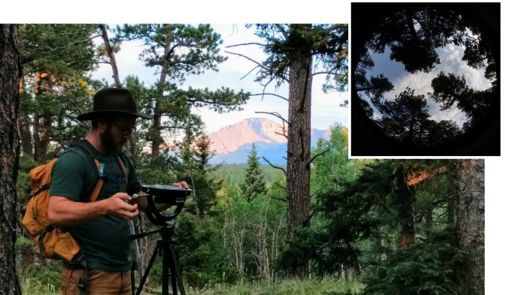
Forest restoration efforts in ponderosa pine forests in the Interior West focus on reducing forest densities to direct forests towards greater resilience to the impacts of fire under increasingly warm and dry conditions. Restoration efforts also strive to restore the complex tree spatial patterns that historically characterized these forests and drive a number of ecological processes. Current research efforts in the Pikes Peak Forest Dynamic Plot are underway to understand how changes in the spatial patterns created by mechanical thinning treatments alter tree regeneration such as survival and recruitment of tree seedlings. Currently, we are conducting detailed monitoring of biotic and abiotic conditions such as canopy structure; soil and air temperatures; light, nutrient, and moisture levels; and microbial communities to better understand how these important drivers of tree regeneration respond to changes in tree spatial patterns. Data generated from this research will inform how various forest management strategies influence forest dynamics and fuels treatment longevity.
~ Led by Jeff Cannon
Forest structure influence on pollinator biodiversity
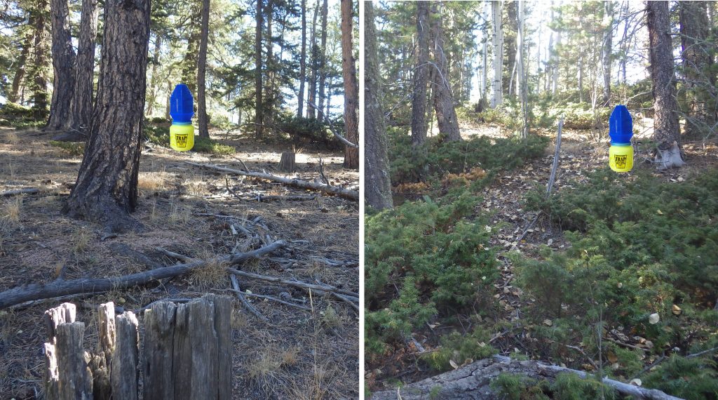
Pollinators are critical to ecosystem function and composition, however, there is remarkably little known about factors driving the biodiversity of wild pollinator communities in forest systems. Scientists from CSU are evaluating trends in pollinator community dynamics and abundances across the growing season in the montane forests of the PFDP. Pollinator samples were compared with forest structural attributes and understory forb community assemblage to understand their influence on bee species abundance and diversity. Early analysis shows that bee communities vary considerably over the course of the growing season, however, floral diversity and forest structure have strong effects on bee abundances. Increasing forest density is associated with a decline in floral resources, and a corresponding decline in bee presence. Understanding these dynamics is important for designing conservation measures aimed at preserving the integrity of pollinator communities, particularly in a forest-restoration context.
~ Led by Seth Davis
Remote characterization of forest inventory parameters
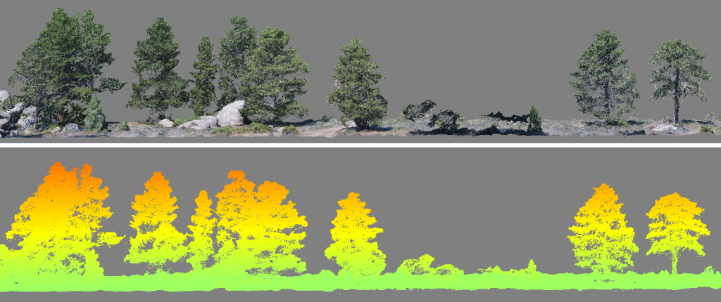
Linking fine-scale forest structure and ecosystem processes is essential for the design and assessment of sustainable forest management strategies that support a range of ecosystem services (e.g. timber production, carbon sequestration, water regulation, protection from natural hazards, preservation of biodiversity, and recreation). Traditional forest inventory techniques were designed for assessing stand-level averages and thus leave a data gap that managers must overcome because they lack the resolution to inform management strategies that operate on fine-scale forest structures. Over the last three decades, practitioners have looked to remotely sensed data to augment traditional inventories, and ultimately provide forest inventory observations with high spatial resolutions. The PFDP provides a unique dataset of spatially explicit observations that will facilitate developing and validating remote sensing data acquisition and processing routines capable of providing accurate and efficient estimates of forest structure at scales meaningful to emerging management practices.
~ Led by Wade Tinkham & Mike Falkowski
Relationships among forest ecological factors and soil microbial communities
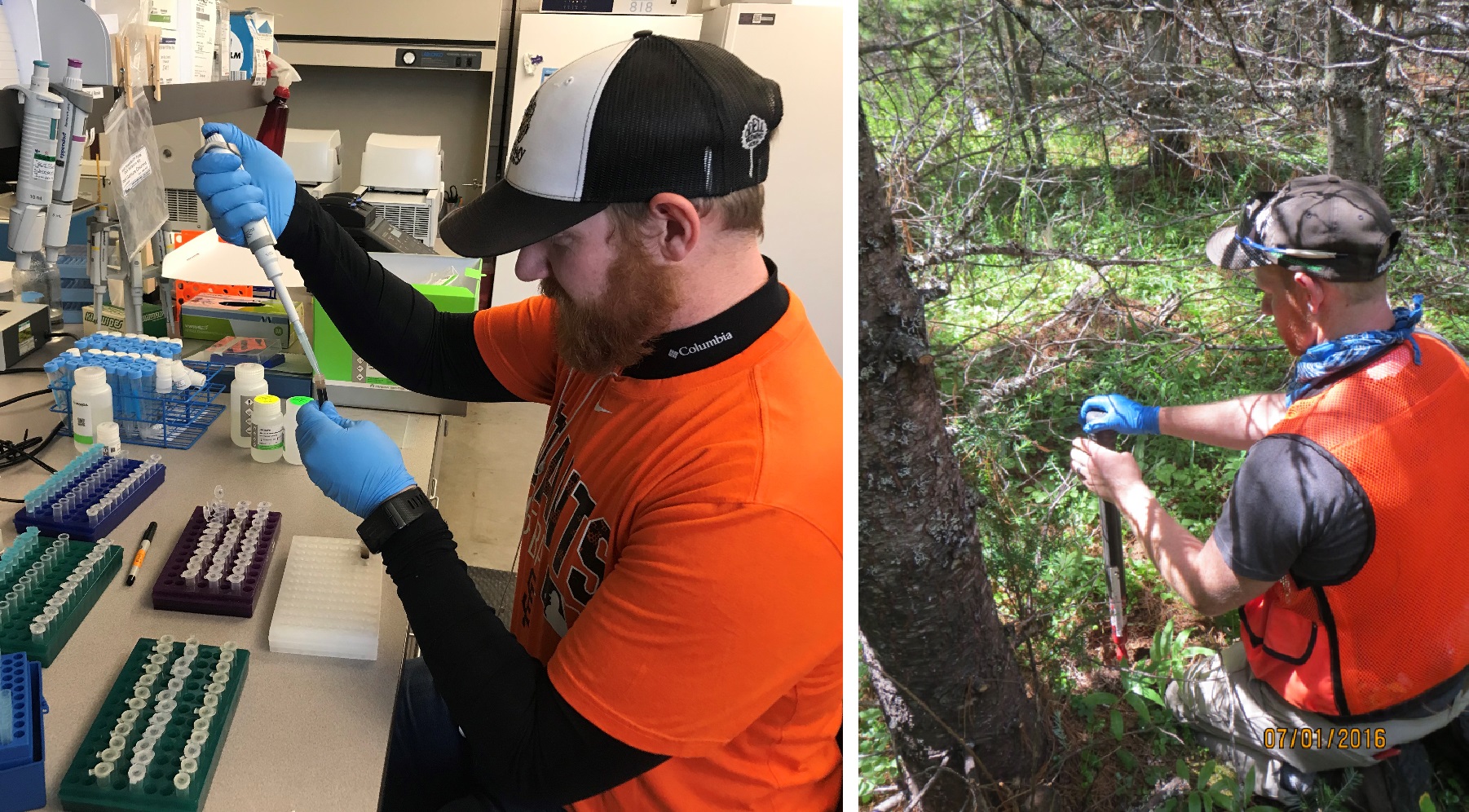
Soil microbial communities may play a role in overall forest health and these are likely influenced by interactions within diverse forest ecotypes. Studying the microbiome of forest soils in conjunction with above ground ecological factors may elucidate factors that promote healthy forests and detect areas at risk for pathogens or pests. The Pikes Peak Forest Dynamic plot provides a variety of forest types and topography to analyze how tree species, soil moisture, temperature and other stand characteristics are correlated with varying fungal and bacterial communities. Current research at Pikes Peak Forest Dynamic plot is examining soil health and microbial communities in roughly 25% of the 1 m2 plots to determine relationships among seedling regeneration levels, fuel loading, understory composition, stand density and the soil microbiome. Understanding what microbes are present will help establish a baseline for each forest type on the stand and recognize potential risks that persist in the soil.
~ Led by Brad Lalande & Jane Stewart
Use of topography and forest structure to map fine-scale fuel spatial variability
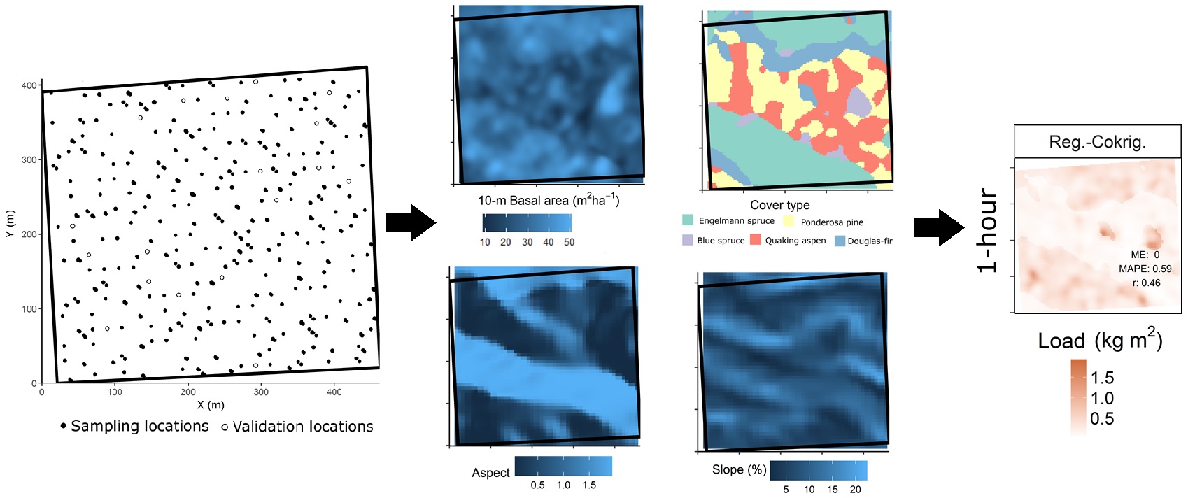
Fuel mapping efforts often apply a spatial interpolation method (SIM) to limited inventory samples in order to produce spatially-continuous predictions of fuels attributes. However, many ecologically-relevant fire behavior and effects occur at fine scales necessitating both broad predictive capability and accuracy. Further, the advancement of geospatial information software has made many SIMs easily available but different SIMs may or may not account for the myriad sources of variability. This study uses the PFDP stem map and collocated surface fuel samples to compare the performance of multiple SIMs of varying complexity, from classification to regression-cokriging, for estimating and mapping fine-scale surface fuel loads over the 17.6 ha study area. Surface fuel loads include litter, duff, and woody fuels in the following diameter classes: >0.6 cm, 0.6-2.5 cm, and 2.5 cm to 7.6 cm. This study should be able to inform the the optimal fuel mapping approach through cross- and external-validation but also assessment of relative sources of uncertainty in fuels mapping including the overstory structure, topographic features, and the spatial structure of surface fuel loads.
~ Led by Chad Hoffman & Justin Ziegler
Spatial relations of complex topography and fire
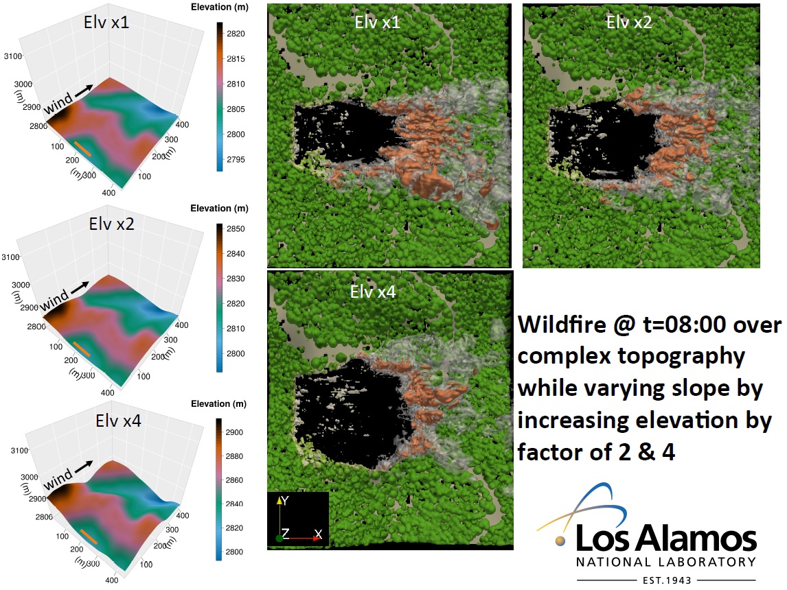
A fire’s behavior is directly influenced by the arrangement of topographic feature it encounters and managers need to account for these forces to safely and successfully manage wildland fires. To better understand the influence of complex topography on wildfire behavior, vegetation and terrain data from the PFDP is being used in model simulations of wildfire behavior. The physically based coupled atmospheric wildfire behavior model HIGRAD/FIRETEC is being used for this purpose. Two groups of simulations are being run. First, results over the complex topography in the PFDP are compared to the same vegetation with flat topography, constant increasing slope and constant decreasing slope. Second, the complex topography in the PFDP is compared to the same vegetation while varying topographic slope by increasing elevation by a factor of two and four. The results of these suite of simulations will be useful to better understand the physical mechanisms responsible for controlling wildfire behavior in complex terrain to improve wildfire management in these areas.
~ Led by Kurt Solander
